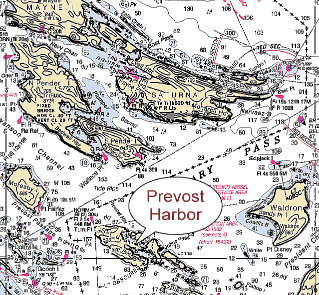
Cruising Distances in the Pacific Northwest From/To Prevost Harbor, Stuart Is.
48° 40' 40.83" N, 123° 11' 53.45" W - NOAA Chart 18432 |
|---|
| | | Speed= | 7.0 | knots | |
| From | To | Nautical
Miles | Hr:Min | Remarks | Chart |
|---|
| Prevost Harbor, Stuart Is. | Anacortes, Fidalgo Island | 29.0 | 4:08 | via Pole Pass |  |
| Prevost Harbor, Stuart Is. | Bedwell Harbour, S. Pender Is. | 4.6 | 0:39 | |  |
| Prevost Harbor, Stuart Is. | Bellingham | 35.6 | 5:05 | |  |
| Prevost Harbor, Stuart Is. | Birch Bay | 23.1 | 3:18 | |  |
| Prevost Harbor, Stuart Is. | Blakely Is. Marina | 18.0 | 2:34 | |  |
| Prevost Harbor, Stuart Is. | Deception Pass | 30.6 | 4:22 | |  |
| Prevost Harbor, Stuart Is. | Deer Harbor, Orcas Is. | 10.3 | 1:28 | |  |
| Prevost Harbor, Stuart Is. | Friday Harbor, San Juan Is. | 13.0 | 1:51 | |  |
| Prevost Harbor, Stuart Is. | Jones Is. | 8.0 | 1:08 | |  |
| Prevost Harbor, Stuart Is. | Matia Island | 15.4 | 2:12 | Stuart Island |  |
| Prevost Harbor, Stuart Is. | Orcas | 12.6 | 1:48 | |  |
| Prevost Harbor, Stuart Is. | Point Roberts | 21.1 | 3:01 | |  |
| Prevost Harbor, Stuart Is. | Reid Harbor, Stuart Is. | 5.1 | 0:43 | Around Stuart Is. via Johns Pass |  |
| Prevost Harbor, Stuart Is. | Reid Harbor, Stuart Is. | 7.3 | 1:02 | Around Stuart Is. via Haro Strait |  |
| Prevost Harbor, Stuart Is. | Roche Harbor, San Juan Is. | 7.1 | 1:00 | via Johns Pass |  |
| Prevost Harbor, Stuart Is. | Roche Harbor, San Juan Is. | 8.5 | 1:12 | via Turn Point |  |
| Prevost Harbor, Stuart Is. | Skyline Marina, Flounder Bay | 25.3 | 3:36 | Stuart Island |  |
| Prevost Harbor, Stuart Is. | Sucia Island | 13.9 | 1:59 | via Boundary Pass |  |
 View Larger Map